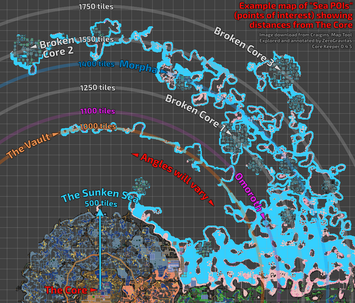
File:Annotated map of Sunken Sea POIs.png

Size of this preview: 702 × 600 pixels. Other resolution: 1,094 × 935 pixels.
Original file (1,094 × 935 pixels, file size: 470 KB, MIME type: image/png)
Annotated map of Sunken Sea POIs rendered by Craigins Map Tool.
File history
Click on a date/time to view the file as it appeared at that time.
| Date/Time | Thumbnail | Dimensions | User | Comment | |
|---|---|---|---|---|---|
| current | 12:33, September 25, 2022 | | 1,094 × 935 (470 KB) | ZeroGravitas (talk | contribs) |
You cannot overwrite this file.
File usage
The following page uses this file: